Book reviews
 
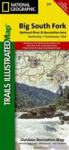
Big South Fork, National River & Recreation Area (Trails Illustrated Map #241) (National Geographic Maps: Trails Illustrated)   

Big South Fork, National River & Recreation Area (Trails Illustrated Map #241) (National Geographic Maps: Trails Illustrated)


National Geographic Maps

Map. Natl Geographic Society Maps 2007-08-01.
ISBN 9781566953542
Buy from Amazon.co.uk


Publisher description

This Trails Illustrated topographic map for Big South Fork National River & Recreation Area in southern Kentucky and northern Tennessee is the perfect map for hiking, biking, exploring, climbing, camping, and sightseeing in this stunning area.

The map includes Daniel Boone National Forest, Big South Fork National River and Recreation Area, Scott State Forest, Cumberland River, Little South Fork, Big South Fork, and Clear Fork, New River, Lake Cumberland, Yahoo Falls Scenic Area, Blue Heron Area, Bandy Creek Campground, Leatherwood Ford, Honey Creek, Burnt Mill Bridge, Alum Ford, John Muir Trail, Bear Creek Overlook, and much more. Includes UTM grids for use with your GPS unit.

Scale = 1:45, 000 & 1:22, 500 Size: 26'' x 38''


More books by National Geographic Maps

Similar books

Rate the book

Write a review and share your opinion with others. Try to focus on the content of the book. Read our instructions for further information.

Big South Fork, National River & Recreation Area


Your rating:  1 2 3 4 5

Please enter a title for your review (min 2 words):


Type your review in the space below (max 1000 words):


Language of the review: 

Your name (optional):


Your email address (not displayed, only for verification):


Big South Fork, National River & Recreation Area (Trails Illustrated Map #241) (National Geographic Maps: Trails Illustrated) Your review will be displayed within five to seven business days.

Big South Fork, National River & Recreation Area (Trails Illustrated Map #241) (National Geographic Maps: Trails Illustrated) Reviews that doesn't follow our instructions will not be displayed.


Book reviews » Big South Fork, National River & Recreation Area (Trails Illustrated Map #241) (National Geographic Maps: Trails Illustrated)
Big South Fork, National River & Recreation Area (Trails Illustrated Map #241) (National Geographic Maps: Trails Illustrated)
  
Categories

Address Books & Journals

Art & Architecture

Biography

Business, Finance & Law

Comics & Graphic Novels

Computers & Internet

Crime, Thrillers & Mystery

Fiction

Food & Drink

Health & Family

History

Home & Garden

Horror

Mind, Body & Spirit

Music, Stage & Screen

Poetry, Drama & Criticism

Reference & Languages

Religion & Spirituality

Science & Nature

Science Fiction & Fantasy

Scientific & Medical

Society & Philosophy

Sports & Hobbies


Book reviews | Help & support | About us


Bokrecensioner Boganmeldelser Bokanmeldelser Kirja-arvostelut Critiques de Livres Buchrezensionen Critica Literaria Book reviews Book reviews Recensioni di Libri Boekrecensies Critica de Libros
Book reviews